


River Facts
Rivers ['rĭ-vûrz]
Streams of freshwater that flow across the land into a body of water such as a lake or ocean.
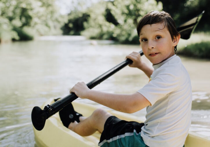
The River
A river has a life just the same as any living thing. A river is born at its headwaters and finishes up at its mouth. Come along for the trip as we visit an entire river. Later we will learn about unique aspects of rivers, the cycle of water on the earth, and the rivers of Idaho.
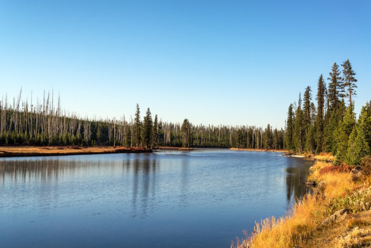
Headwaters
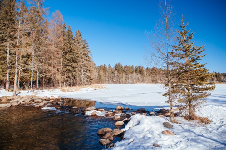
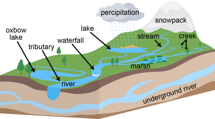
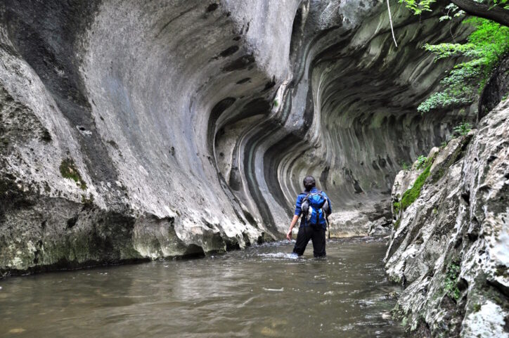
It starts with a drip. Often from melting snow high in a mountain range during the warming of spring.
The drips collect together until they form a small puddle. This puddle begins to run down the slope of a hill or mountain in a very small trickle. This is the start of a river. Although very small, this is where it all begins. This is called the headwaters or the source. It doesn't start in one specific place but in many locations generally around the highest part of the landscape.
Creek, crick, brook, brooklet, stream, rivulet …
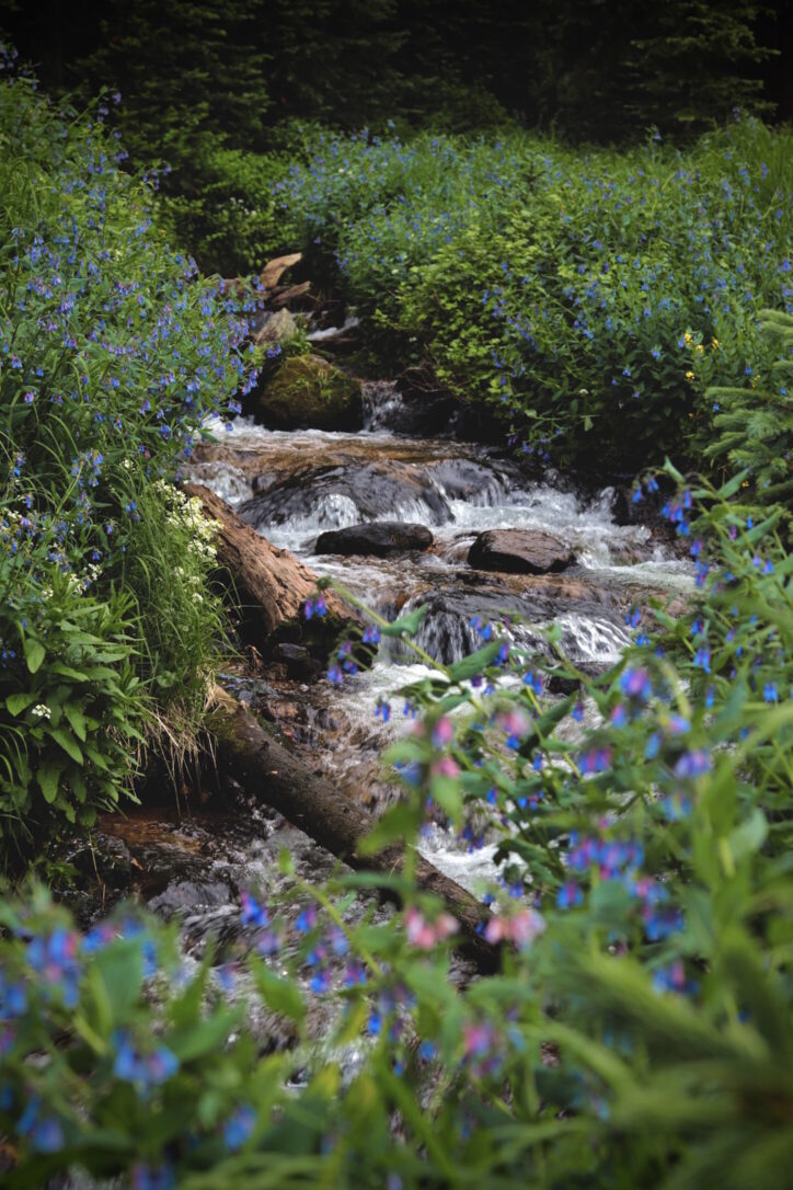
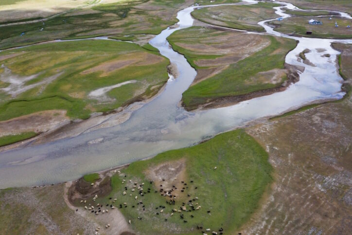
It is known by many names, but they all mean the same thing. As the water trickle begins to gather and take shape, it starts out very small. Water from several locations begins to collect into miniature rivers. These are the creeks or streams. They may be only an inch across or they could gather into a larger version that may be several feet across.
The water is pulled by gravity down the slope of the landscape. And all along its path it finds more water also on the same journey. The small streams gather together and move down the mountains; all the while finding more and more water on the route to the lowest point - which will usually be its final goal - the ocean.
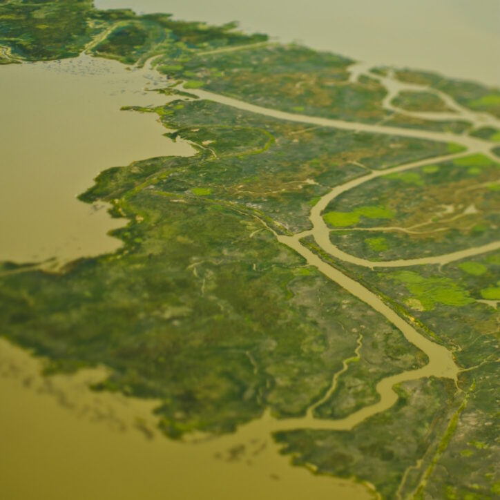
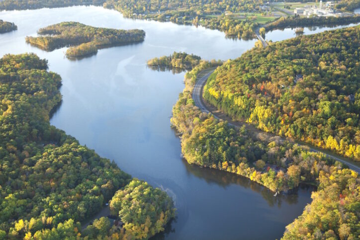
Tributary
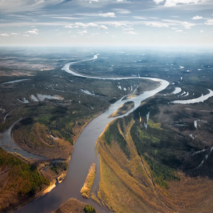
The dripping becomes a trickle, a trickle becomes a stream and streams collect together to make a river. But it doesn't stop there. Rivers will find each other too and assemble into a wider and bigger river. Along the way, rivers will gather together just the same as the streams gathered into one.
When rivers form this type of a family, we call each of the small rivers a tributary. Where they meet is a fork. At the fork, a small river flows into a larger river. One river can take all of the rainwater from a given area and move that water off to drain away. This is known as the drainage basin. The picture above shows an overhead view of several tributaries flowing into a larger river, much the same way that branches of a tree all connect to the trunk.
Mouth
A river or tributary must empty into a larger body of water somewhere. It might be another river, a lake, or an ocean. The place where river water empties into another body of water is known as the mouth. The mouth of a river can be a place where deposits of silt, sand, clay, and soil build-up and where wildlife gather to feed. Sometimes the river widens at the mouth and spreads out due to all the sand and other materials the river has picked up and carried along its way.
Estuary
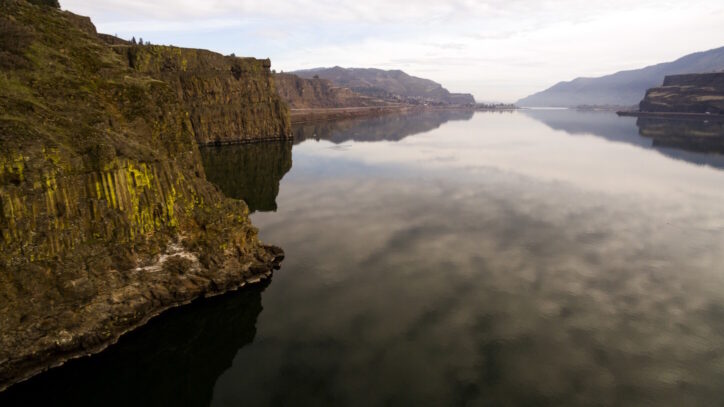
Most of the rivers in Idaho head for the Columbia River. The Columbia eventually empties into the Pacific Ocean. It is the joining of the Columbia with ocean water that we call the mouth. Here, freshwater mixes with salty ocean water. This place is called an estuary. The water in an estuary is often not fully salt water, but would not be good to drink because enough salt has invaded it to give it an odd flavor. This water is known as brackish water.
Parts of a River
A river never moves from its headwaters directly to the mouth without changing the land that it travels through. The changes that a river makes upon the land help to define a river's shape, size and even its beauty. Let's take a look at some of the parts of a river and how it becomes this way.
Glaciers
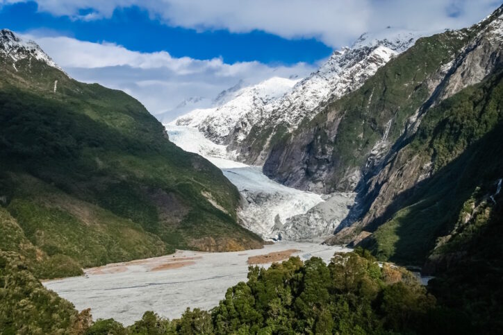
Way up the mountains in some parts of the world sits a glacier. Years of snow and ice have accumulated over time and have built up a thick, heavy mass of frozen material. Some of this never really melts or it might partially melt and then refreeze. A glacier is actually a river of snow and ice which moves very, very slowly down its course. As it moves, it can drag soil and rock along with it.
A glacier is great at carving a valley as it travels along. Sometimes a glacier can create a basin or bowl-shaped formation. A glacier can move rocks and deposit them miles from their original source or location. Rocks, gravel, and sand from glaciers have been found sitting lonely and far away from the place of a prehistoric glacier. This discarded material is called a moraine and is used to identify glaciers of the past.
Erosion
Moving water is a powerful force and can wear away soil and rocks. Soil washes down steep slopes especially when there are no plants or trees to hold the soil in place. The moving of soil and rock is called erosion.
Erosion is responsible for filling rivers with mud after a heavy rain or a forest fire. The mud can choke out fish and make the water undrinkable for other wildlife. The moving soil in the river will also act to erode additional rocks and soil. The soil and water can bounce sharp-edged rocks and pound them with sand and gravel. This continues the erosion process. When the rocks have been worn down to smooth edges, they are easily identified as river rock.
Good soil that plants need to hold them in place and feed them can get moved far away from the plants. Those plants will die. In addition to water, erosion can be caused by wind, glaciers, or the activities of animals and humans. Each of these can stir up soil and cause it to move to another location.
Valleys
Erosion is also responsible for creating valleys in mountains. The V-shaped grooves are created by water-eroding soil from a hill or mountain in a short period of time. This swift means of taking soil away from the mountain often defines the shape of a peak and creates the highs and lows of a mountainside. The U-shape of an older valley is evidence of erosion that has taken place over a long period of time where additional erosion from rocks, sand, and gravel has moved much more material from the valley floor.
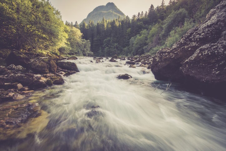
Waterfalls
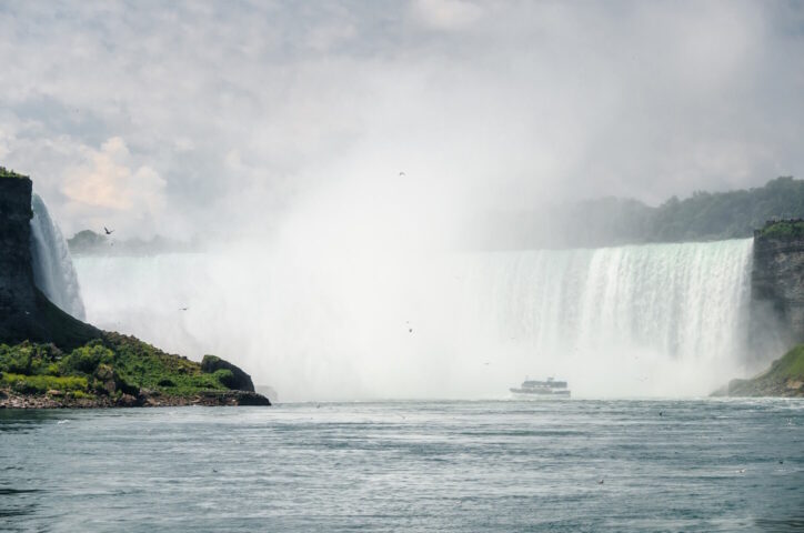
Waterfalls are often some of our favorite scenery in nature. We take pictures of them and build parks for people to enjoy them. Some people even create their own waterfalls in their backyards. But nature's waterfalls are just another sign of the power of moving water.
Waterfalls, because of their speed, can move huge amounts of rock and soil. A waterfall can dig a hole at the bottom of its flow known as a plunge pool. The soil and rocks that once sat at the bottom of the waterfall have been moved on downstream. If you could stop the flow of the water you could see that there is an indentation right below where the water drops. The moving water usually prevents us from viewing this pool. The moving water can also wear away the rocks at the top of the waterfall and the shape of the waterfall can change as the years go by.
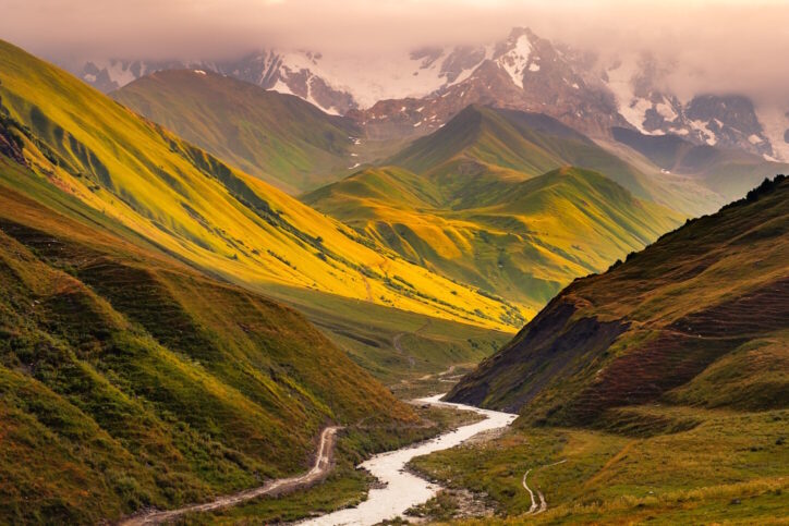
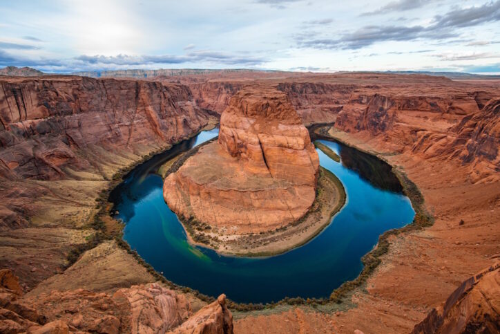
Meander
As a river flows over years and years, it can create a new path for itself. It can wind its way around rocks and trees and then change its route another year. It can pick up soil material from one area and drop it in another area, creating a new route for it to follow. This twisting and turning of a river is known as a meander.
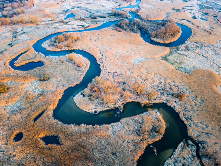
If conditions are just right, a river can abandon one U-shaped section of its meander to create a lake. This is known as an oxbow lake. See the oxbow in the picture? It is in the far right side of the meander.
Flood Plain
During the spring, melting snow can create more water than a river can carry. When the river is uncontrolled, the banks of the river will overflow and the water will spill out over the nearby land causing a flood. Depending on the amount of winter snow and spring melt, this flooding will repeat itself every season.
By watching where the water will end up, farmers can predict the areas that will be affected and plan where to build houses, where to plant crops, and even where to keep their cattle. This area of flooding is known as a flood plain.
In recent decades, people have tried to control the water better through the use of dams. Water can be stored behind the dam and let down as needed. This doesn't stop flooding all of the time, but it can be helpful. Learn more about dams at Science Trek's Dams website.
Canyon
As a river travels and carries away rocks and soil, it can create a deep groove in the earth's surface. All along the sides of the river, the groove can get deeper and deeper. In time, this can create a canyon. Depending upon the type of rock along the sides of the river, a canyon can have sharp cliff-like sides. Some canyons are very famous, such as the Grand Canyon or the Snake River Canyon.
Delta
At the mouth of many rivers, a delta can form. A delta is made of the soil and debris that the river has washed down its entire route. When the river comes to the mouth, the speed of the water often slows and it allows the material to pile up there.
Deltas can be all shapes but are usually formed in a fan shape or a triangle. Over time, this material can become very thick. Even thick enough to build on. The city of New Orleans, Louisiana is built on the delta of the Mississippi River where the river meets the Gulf of Mexico.
The Water Cycle
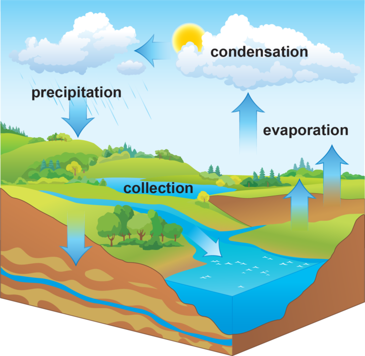
Rivers are just a part of a bigger earth process known as the water cycle. All of the water that has ever existed or ever will exist is here on the earth today. The same water that your favorite dinosaur drank might be the water you drink later today. Some of the earth's water is frozen, some of it is in a gaseous form (water vapor), and then some is liquid. Water can be in any of these forms here upon the earth. Some water is even part of living things. It is in your body, it is in the trees, it is in your food, and it's even in the air. This water goes through a constant cycle of movement which cleans, redistributes, and stores it for later use.
The water cycle consists of three basic parts: evaporation, condensation, and precipitation.
Let's start with evaporation. Water in lakes or in the oceans is heated by the sun. This heated water evaporates into the atmosphere in the form of water vapor. When the water vapor reaches a certain height in the atmosphere it begins to cool down. This causes it to change back into water droplets. This is called condensation, which takes the form of clouds. We think that they look like white, fluffy marshmallows, but they are really just a collection of tiny water droplets. If the conditions are just right and enough water droplets have collected, then they get too heavy for the atmosphere to hold and they begin to fall to the ground. If the air is cold enough, they might fall as snow; warm enough and they will fall as rain. Sleet and hail are other ways that water can fall to the earth. All of these are called precipitation. Much of the precipitation falls over mountainous areas and collects as snowcaps or glaciers. When these begin to melt in the spring and runoff, we have rivers!! The rivers flow to a lake or an ocean and the cycle starts all over again.
Still More Fascinating Facts
- One acre of corn gives off about 4,000 gallons of water per day back into the air.
- One gallon of water weighs a little over 8 pounds.
- There are nearly 100,000 glaciers in Alaska.
- Ice worms live on glaciers and eat pollen, insects, mineral and bacteria that is deposited there by the wind.
Idaho River Facts
| River | Length | Drainage Basin | Location |
|---|---|---|---|
| Snake | 1040 miles (1670 km) | 109,000 sq miles (282,000 sq km) | Eastern, southern & west-central Idaho |
| Salmon | 420 miles (680 km) | 1206 sq miles (3124) sq km | Central Idaho |
| Boise | 95 miles (150 km) | 2122 sq miles (5496) sq km | Southwestern Idaho |
| Clearwater | 90 miles (145 km) | 9645 sq miles (24,980 sq km) | North Idaho |
| Payette | 62 miles (100 km) | 3240 sq miles (8390) sq km | West-central Idaho |
Fascinating Facts
- There are more than 250,000 rivers in the United States.
- The Mississippi is the largest river in the U.S.
- Water covers three fourths of the earth's surface.
- Most of that water is permanently frozen or salty.
- Antarctica holds over 90% of the word's fresh water.
- The amount of water on the earth has remained the same for two billion years.
- If all of the world's water could fit into a gallon sized container, only 1 tablespoon of that water would be drinkable fresh water.
- 1.2 billion people in the world do not have access to clean water.
Fun Links
Learn more about meandering rivers and how they change the landscape. Visit Castle Rock Fossil Rainforest.
What's a vernal pool? PBS has a great video for you to find out about vernal pools.
Where does water go? Follow the Water is a great video from PBS that takes you on water's long journey.
Learn more about erosion at Science for Kids! They have facts, pictures, diagrams, and more!
Find out more about geography and erosion from Geography4kids.
Here's an introduction to rivers from a British perspective.
Water and the water cycle from Geography4kids
Check out these BBC Learner Guides on the Water Cycle and River Landforms.
The Snake River is Idaho's longest river. Britannica.com offers some basic facts.
Then, find out more about Idaho's Wild and Scenic Rivers.
Top 10 Questions
April 2017
Thanks to James McNamara, professor and chair of the department of geosciences, Boise State University and Elowyn Yager, associate professor, department of civil engineering, Center for Ecohydraulics Research, University of Idaho for the answers.
-
How do you make rivers?
You can make a river by creating a depression in the ground and having the water that you pour into that depression move from an area of high elevation to an area of low elevation. That is essentially what is driving the flow in a river. (From Brock at Amity Elementary School in Boise)
-
How did rivers get their water?
Rivers get their water from rain and snow. The water from the precipitation goes over the whole watershed, and eventually that water flows through the landscape and into the river. (From Amanda at Dalton Elementary School in Dalton Gardens)
-
How do rivers move?
Rivers move by eroding sediment or rocks within them. They will pick up rocks from of their bed, or from their banks, and transport them from one place to another. By transporting rocks from the banks of the river, they can erode one side of the river and deposit sediment on the other side thereby having a river literally migrate back and forth across its floodplain. (From Cayden at McDonald Elementary School in Moscow)
-
What is the deepest river in Idaho?
The deepest river in Idaho is the Snake River as it goes through Hells Canyon. At that point, it can be between seven and 8,000 feet deep. That depth is the depth of the river canyon, and not the flow depth of the river. This canyon is the deepest canyon in North America. (From Bryn at Russell Elementary School in Moscow)
-
How do dams affect the river and its environment?
Dams block the flow of water, and this creates lakes behind the dam. This is very useful for using the water later in the summer. (From Landen at Trail Wind Elementary School in Boise)
-
Why are rivers different colors?
The color of a river is dependent on where the sediment, or dirt, in the river comes from and how much there is. (From Trinity at Whittier Elementary School in Boise)
-
Why do rivers flow?
Rivers flow because of gravity. Although rivers may look flat, they actually slope like a hill. Gravity makes the water flow downhill. (From Genevieve at Garfield Elementary School in Boise)
-
How much drinking water comes from rivers?
Almost 70 percent of municipalities within the United States take drinking water from surface sources. That is either lakes or rivers, but how much is just from rivers is questionable. In Boise, we get a significant amount of our drinking water from groundwater rather than from rivers, but the rivers here do contribute some to our drinking water. (From Daxton at Trail Wind Elementary School in Boise)
-
Can you actually find gold in rivers?
Yes, you can! You can go to rivers and pan for gold. The gold that you find in rivers eroded from rocks in the landscape. In Idaho, we used to have many people searching for gold. You can find little bits of it in the rivers now but probably not much as in the past, because most of it has been removed already. (From Ruby at Trail Wind School in Boise)
-
How are deltas made?
A delta is the location where a river enters a larger body of water that is moving more slowly, if at all. We have the Mississippi River Delta where the Mississippi River enters the ocean. A delta forms when the fast moving river has to slow down as it enters the slower moving body of water. When it slows down, it deposits all of the rocks that it was carrying, building up sediment. This buildup makes the delta. The river will migrate back and forth over the delta, causing the lobe-like shape. (From Bella at Trail Wind Elementary School in Boise)